Paonia, Colorado Wine and Orchard Tour

I had a long weekend October 16-19, with Monday off work as a required furlough day, so I decided to head to Western Colorado. It was my first solo trip in a while, since Nick had to study for midterms.  It seemed like a nice time of year to head out to the area, which is warmer than the Denver area this time of year. For the first day, I decided to drive to Paonia, Colorado. I had heard this was a cool area, but found that you could camp in an orchard, which sounded like a fun way to spend a night of the trip.

I did the typical drive from Denver, heading west on I-70; however, I had yet to drive through Glenwood Canyon since fires earlier this year. I could definitely see some burned landscape, but it was really beautiful as there were a lot of fall colors near the rushing river. Then, I turned onto 133 to get to Paonia, which was all new driving for me. The landscape was really beautiful, with lots of golden fall colors and a river.

It’s a bit over a four drive, but it was lovely, and I made it to the small, cute town of Paonia. I walked around a bit and considered doing lunch there, but I had spotted a few wineries on the way in and wanted to visit those – there was one that had a market as well for food.

I decided to head back to a winery I had spotted on the way to Paonia, just a few minutes away. Blackbridge Winery was down a road next to a river. It was cute as soon as I arrived and they had a lot more than wine – there was a whole pumpkin patch outside! They also had a market with lots of local products from honey to pasta to local art.

I wanted to do a wine tasting. I found the couple running the wine tasting super nice and down to earth, and my tasting included 5 wines which I could choose and the glass below. They had a variety of red and white wines including a Peach wine that was not very sweet but dry, which is nice! Palisade especially in this area of Colorado is known for producing peaches. I grabbed a bottle of their Alpine White, which was on sale.

Black Bridge Winery has an amazing setting along a river, which was stunning this time of year with fall leaves, mountain views, vineyards, and 60s-70s sunny temperatures. They invite you to picnic with a bottle of wine along the river, and have some picnic tables and chairs set up – you can even buy some nice cheeses and snacks inside. It’s definitely a place I want to return to! You could spend several hours JUST here.

But, I did want to check out some other wineries too. Next, I headed to a spot I’d seen right near the road – Qutori Winery/Root and Vine Market.

There was a patio with a just gorgeous view of the vineyards across the way, where many of the wines are made from. I tasted a few and settled on a lovely rose and a croissant sandwich from the market. The people were once again very nice. There was a lovely watercolor mural in the winery tasting area (inside but open air) that the woman told me the owner and her son had completed themselves. This was a lovely, peaceful setting to enjoy lunch. There was another solo person at a table nearby, and we started chatting. He could work remotely so had moved to the area and loved it. It was fun to travel solo and be able to make a socially distant friend! I told him I wanted to head up to Azura Winery next, and he said that had the best views. He was not wrong as you will see!

Azura has a Mediterranean feel to it. You drive up a mountain a bit to these beautiful buildings, which include a small art gallery. The tasting was all outside, and then the seating was outside overlooking just a gorgeous view. Once again, the woman doing the tasting was very nice and invited me to check out the art gallery (which was empty of people) and the lake for the “yacht club,” in which its members use small remote control boats. I ended up with a glass of the “Yacht Club Red.”

The views here were truly stunning. My last stop, the camping spot at Big B’s Orchard, was only a five minute drive away. I wanted to pace myself in enjoying the wine (and ensure I was drinking lots of water!), so I sat for a while and listened to a podcast (I got no cell phone reception here), and enjoyed the view.

Big B’s Orchard is a really fun, unique place that’s also a cidery. There is a store, cafe, and huge outdoor area with tables and swings. It was still lovely late in the afternoon. The store has all kinds of produce and goods! I got apples and some cherry tart cider to go (all excellent). I also ate a delicious pulled pork sandwich and enjoyed the outdoor area.

I then walked around the orchard a bit and enjoyed some fall colors and nice views before heading to my campsite, right in a row of the orchard.

I really enjoyed the simple campsite – I had a picnic table and set up my chair and tent. There were campers in other orchard rows, so I felt safe and not alone, but also had some privacy in my little area. I read for a bit, but sunset is early these days – 6:30 pm! It’s very different from backpacking where I often was tired and just waiting for the sun to go down at 9 pm.

I feel asleep quickly, but woke up around 10 pm and then saw the most amazing stars I’ve ever seen – I didn’t really get a great capture on my phone, but it was stunning! Overall, it was a fun campsite, and I’d love to spend more time at Big B’s in the future.

Covid-19 Notes: Overall, the places I went were very naturally set up for pandemic safety. I wore a mask whenever I wasn’t seated eating, and everyone else did as well. There were all outdoor seating areas, and even areas technically “indoors” had a large garage door or door opening to allow for air flow. The camping check in was in the store, which had open doors for air flow, and was quick. My campsite was very spaced from others so that I enjoyed privacy.

My next blog post will cover heading from Paonia to Palisade for a winery bike tour.
 

Blue Lakes Backpacking (Mt. Sneffels Wilderness)

Over the fourth of July holiday this year, Nick and I decided to head out to the Telluride/Ouray area of Colorado, six hours away. I did not think it would feasible to do much of anything when the pandemic hit, so I was excited we were able to take this road trip. We decided we would keep it safe by doing only dispersed and backcountry camping, in which there are no facilities. We had a fun drive out on Wednesday, July 8, stopping in fun places like Buena Vista and Salida along the way. Our goal was to get to a dispersed camping spot near the trailhead of Blue Lakes in the Mount Sneffels Wilderness so that we could begin a backpacking trip there the next day. I had somehow seen this hike and marked it as something I wanted to do as soon as I saw the pictures, but knew it would be a long drive. I was so excited when I realized we could actually do it.

We drove down a rocky road and wondered if there even was a dispersed camping site, but enjoyed gorgeous scenery with 14er Mount Sneffels in the background. When we got to the site, we were amazed at how stunning it was.

The weather was so clear that we were actually able to have our tent in stargazer mode. Whenever we woke up, we saw tons of stars. I also started testing out the night mode on my camera phone.

The next day, we got up at sunrise to beat the crowds and headed to the nearby trailhead. We strapped on our packs and started a steep, uphill climb. It was gorgeous and peaceful, but started to fill with people. We saw a solo backpacker coming down who told us about an amazing camping spot that we would end up taking. The trail up was tough with lots of stops, but it did start to flatten out a bit towards the end which was nice. It was 3 miles to the lower blue lake.

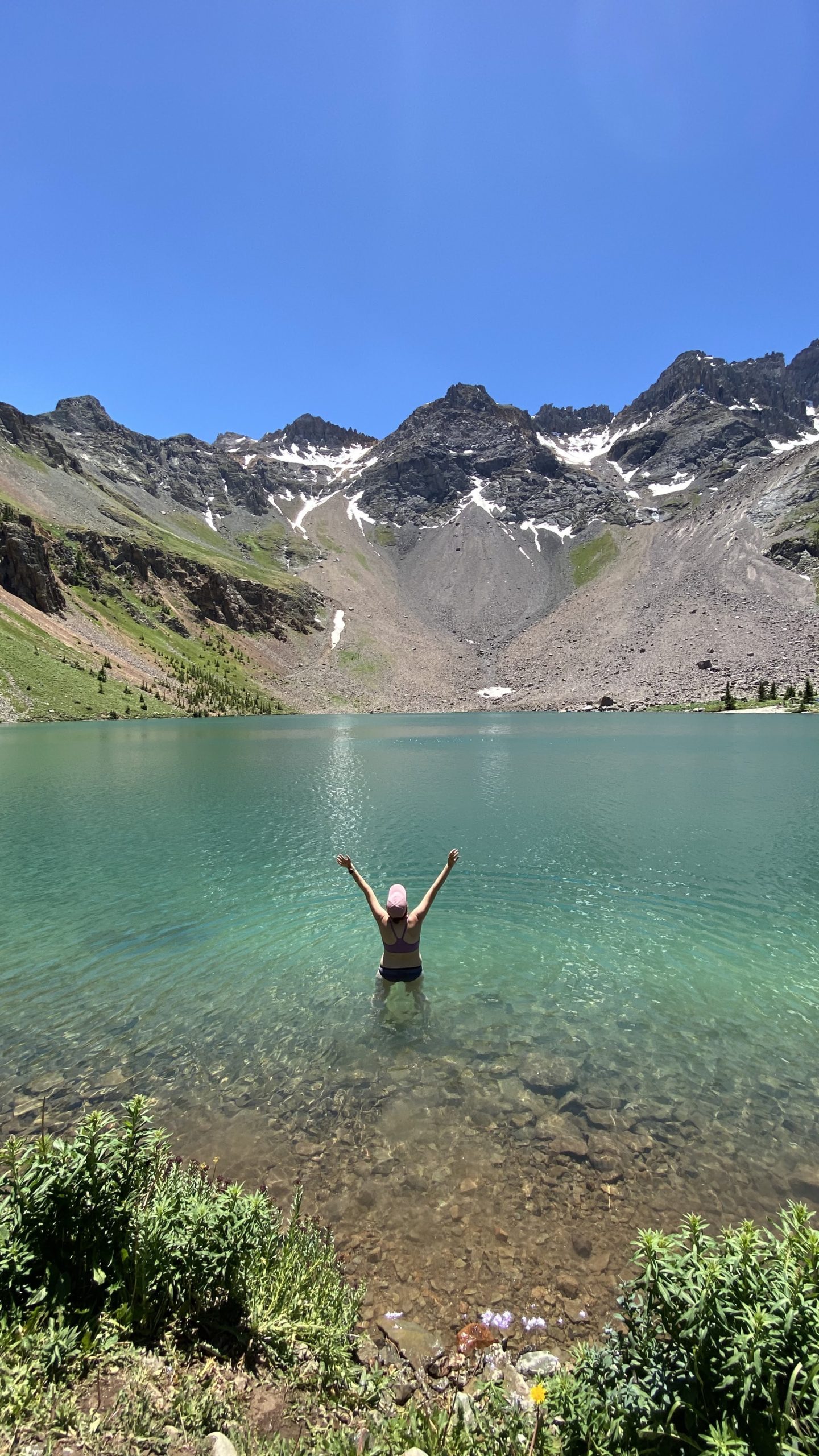
It was definitely worth all the work as we came upon the lake in the morning light. It is truly stunning. I have not altered my photos a bit to get this blue color.

We were there early enough that there were a lot of backpackers still with tents up from the previous night. Based on the advice from the kind backpacker, we snagged this spot:

Truly unreal. Our spot was far from other backpackers and was like our own little paradise, and still far enough from the lake (100 feet away) to be within regulation. The sky was perfectly blue with no sign of a Colorado monsoon. It was so early that once we set up camp, we had our coffee by the lake.

Next, we wanted to do a day hike to the upper lakes. It’s another mile to the upper blue lakes. It was a relief to just have our light daypacks as we headed up the steep path. Fueled by our morning coffee, we got stunning views of the lake below.

It was a tough hike up and the landscape turned rocky, with pikas and marmots scurrying past. Nick and I stopped for a snack break at the first upper lake, which was just as blue as the lower lake.

As you can see, the scenery was truly gorgeous. It felt like being in Lord of the Rings, or Iceland, or Scotland. We took the path to the second lake. It’s not as scary as it looks here! There were also a ton of wildflowers along the way.

We had lunch next to the upper lake. We watched people hike up the steep path to summit Mount Sneffels. Many people camp at Blue Lakes and then tackle the peak the next day. It requires some technical rock scrambling to get to the peak, but apparently, you can see all 3 lakes from the top.

We were ready to get back to our camp to relax for the rest of the day. We hiked down and it was pretty warm at this point. We decided to try getting in the lake, although I struggled to get past my waist deep due to the cold. It definitely felt amazing, and in the sun, you dry quickly. People swim, kayak, and fish in the lakes!

Nick and I settled into our favorite afternoon backpacking activity; reading and hammocking. And you can’t beat these backpacking views. The skies remained totally clear (the lack of rain was bad for Colorado’s fire season but made for good backpacking). It felt extremely peaceful despite the fact that this is a popular hiking and backpacking spot.

We ate dinner by the lake and watched the sun go down. We again were able to leave our tent in stargazer mode (no rain fly) and had the view below.

The next morning, because our tent fly was off, I saw a silent fox scurry through our campsite. We woke early to make breakfast by the lake. We decided to watch the sun come up over the mountains and the lake. It is amazing how different it looks as light hits it differently throughout the day.

We actually spent a perfect 24 hours with the lake, as we had arrived around 8 am the previous day and left around the same time.

It was definitely hard to say goodbye to the lake, but now that it was Friday, we wanted to beat the crowds, so headed out. We saw a ton of backpackers coming up as we left, along with day hikers, so I was glad we were able to do a midweek trip. We passed on our camping spot location to another friendly couple – hope they found it!

We headed to Ouray, a delightful mountain town, for food and drinks, and Black Canyon of the Gunnison as well, before finishing out the night in Salida and finding another dispersed camping spot. These are all places we loved and want to go back to.

Overall, this part of Colorado in the San Juan Mountains is absolutely beautiful. This was a trip we will definitely remember for a lifetime. We would definitely love to repeat it, but we have so many things in our list!  Also in this area are Ice and Island Lakes, which are similarly stunning apparently.

Lost Creek Wilderness Backpacking July 2-5

I had a fourth of July holiday combined with a flex day combined with a furlough day that gave me five days off, and since my boyfriend Nick has not started his grad school yet, we decided to do a multiday backpacking trip. Nick made a YouTube video:

Day 1 – Goose Creek Trail 612

I had done this trail as my first solo backpacking overnight in 2019, so I was excited to go back and knew what to expect. We left early and drove a lot of dirt road to arrive at the trail head. This trail starts looking over fire damage from the 2002 Hayman Fire that burned for a month.

IMG_4224

There were lots of wildflowers the entire hike! We descended into a shady forest along the creek, and had some uphill to gain before the campsite. I hoped to go to the creekside campsite I’d gone to the previous year, about 5 miles in.

Along the hike, we started to see distantly the giant, weird rock formations of the Lost Creek Wilderness.IMG_3820

There a short, worthwhile detours where we put down our packs to explore historic cabin ruins. According to the sign, the Lost Park Reservoir site between 1890 and 1913 attempted to create a reservoir damming lost creek, and these cabins were employee housing hand when from native trees. There’s even remains of beds/mattress/oven. It’s amazing!

IMG_3788

After a some uphill hiking…

IMG_3772

We got to our campsite fairly early (My campsite was free!) and were excited to hammock and read books all afternoon.

IMG_3829 (1)

This was a great first day – no rain all afternoon. We were definitely tired and ready to rest and relax, with the nice trickle of the creek. It was surprisingly not very busy – we only saw a few people pass our camp on the trail. To me, it was a bit exciting and nerve wracking to find out what was next, as the next day we would get into a lot harder elevation gains and new territory.

Day 2 – Goose Creek to McCurdy Park

The next day was our most challenging day that at times made us ask WHY DOES ANYONE DO THIS. We got about 11.7 miles into the loop this day – so did around 6.7 or so miles. There was an incredible variation in landscape this day and steep up and downs. Supposedly we only gained about 1000 feet, but my GPS app measured 2500 between the ups and downs.

When I came in 2019, I’d gone on a bit up Goose Creek. It continues uphill through beautiful forest, which was gorgeous and quiet in the early morning.

IMG_3868

Eventually it opens up to a beautiful viewpoint, which shows you how far up you have come.

IMG_3878

We then turned onto the McCurdy Park trail, which was steep downhill.

IMG_3881

This was a bit ominous – we knew we had more uphill to go. We descended into a beautiful aspen forest. The way that the sun glows through the aspen is quite magical.

IMG_3913

We then had to go up and up and had huge rock formations ahead. It was hot, and challenging. We had a couple of steep up and downs among the red rocks.

IMG_3953

At one point, we descended to a cave with the river flowing through, and a really cool campsite right there. We almost got lost, but our handy paper map plus GPS on phones helped. We stopped for lunch in the shade before pressing on.

IMG_3983

It was hot, with more steep ups and downs. We ran out of water, but descended into an aspen valley near a creek and refilled with our water filter. We really wanted to make it to a meadow we had read about with good camping.

IMG_4004

The last part was challenging. Some clouds, but a storm didn’t really roll through. We had an uphill portion in a forest that seemed endless, and everything hurt. We stopped a few times and made slow progress.

IMG_4009 (1)

We looked so close to the meadow on the map, but it took forever. Finally, we reached the clearing and found some campsites in a beautiful meadow next to the creek.

IMG_4012

It started to thunder so we set up our tent quick and waited out some thunder inside. It was already late afternoon. We were starving so we made our freeze-dried dinners. That chicken fried rice was the most delicious meal ever. However, the mosquitoes were horrible. We covered every part of our body and put our buffs over our faces, and devised a method of walking and eating to keep the mosquitoes at bay.

IMG_4015

We split a cup of hot chocolate inside the tent. Of course, the mosquitoes started to die down as it got cold.

Several other tents joined the meadow – according to the paper map we had, it’s exactly halfway so a good campsite for people doing the trail as an overnight. We were all at least 200 feet apart though.

Day 3 – McCurdy Park to Lake Park to Hankins Pass

We woke up first to a beautiful sunrise, and walked across the meadow to take down our bear bag and make breakfast.

IMG_4023

IMG_4021

We set off feeling much better than the afternoon before. We knew we had a big climb up to the highest point on the trail, 11,500 feet. We went through the “McCurdy Park” area and passed lots of great campsites, including among a forest and out in another meadow.

IMG_4037

We came to the junction of McCurdy Park and Lake Park and took a break before a steep uphill climb through switchbacks. It was at least shaded, and in the first part of the day. At the highest point, there is an incredible pile of red rocks with a great viewpoint.

IMG_4042

We took our lunch break here and rested. There’s an awesome campsite, but I don’t think any water source close (dry campsite). From here, we headed down and down. It started to look more like a desert landscape than a forest, and was not shaded. We saw some trail runners which to me is mind blowing that they run any part of this.

IMG_4110

We headed to a meadow around mile 17 where we had seen some campsites marked, which was we found. However, there didn’t seem to be a good water source close. There was some uphill coming up and so we tried to stop and camp, but a marshy pond was too difficult to get water from. However, the stopping was reinvigorating and we made it up a bit of downhill to go down and down and down.

IMG_4096

We reached the intersection with Hankins Pass. There were very dark clouds that looked scary, but never really resulted in more than some light rain and ominous rumbling.

Then, we were tired and our feet hurt from all the downhill. We looked for a campsite. Hankins Pass luckily didn’t have any high mountain pass climbs, but was a gorgeous forest. However, the campsites we found only had stagnant water – perhaps in wetter years the creek was flowing. We kept going what felt like forever. Around mile 20.2 to 20.5 (so we probably did 8-9 miles this day total), we found a beautiful aspen campsite with a stream. We set up camp and miraculously, it seemed to be bug free. It was surprisingly not too late into the afternoon so we set up our hammocks.

IMG_4150

Nick fell asleep and that hammocking and reading was some of the best ever. The scenery was beautiful. We made a nice dinner and hot chocolate and settled in for more hammocking to watch the sun go down. We settled in for a great sleep knowing that we only had a few miles to go the next day.

IMG_4141

Day 4 – Hankins Pass to HOME

We were ready to head home on our last day. It was a beautiful sunrise as we woke up and made breakfast. The forest was really beautiful with early morning sun shining through.

IMG_4173

The last part of Hankins pass had a few more nice campsites and we started to follow a creek.

IMG_4179

It seemed like we had to cross the water a million times those last 3 miles or so. We stopped very little as it was a nice, peaceful, morning going downhill.

IMG_4198

Finally, we reached the junction with the Goose Creek trail, where we had originally veered left. We headed slightly uphill in the sun to finish the trail. Apps and GPS seem to pin the loop between 21-25 miles – our map says it’s 23.4 miles.

IMG_4208

Overall, this was a challenge for Nick and I, but we had an amazing time. We totally social distanced and completely missed the heat and loud illegal fireworks in Denver for the 4th of July. There’s a lot of backpacking to be done in Lost Creek Wilderness, so we definitely want to try more loops in the future.

IMG_4222

Ceran St. Vrain Backpacking

My first backpacking trip of the summer was also my first backpacking trip with my boyfriend, Nick, and first trip to Ceran St. Vrain trail, just an hour outside of Denver near Jamestown, CO. Last year, I did all my backpacking trips solo in preparation for my Laugavegur Trail trip in Iceland.

We were going to go Friday, but the Friday weather was very stormy and Saturday looked like perfect weather which it turned out to be, no monsoon storms at all! It is rare not to get rained on when backpacking in Colorado in the summer so it was nice. We got to the trailhead around 6:30 am and there were still a good amount of people camping from Friday night.

Ceran St Vrain is a gorgeous trail that runs along a creek for two miles. It’s named after Ceran St Vrain, a fur trader from the 1800s. Nick and I referred to the book Base Camp Denver, which has a nice description of the history and logistics of the trail.

IMG_3466

There were lots of green aspens and beautiful wildflowers as we walked along the trail, listening to the comforting murmur of the creek, including the famous purple and white columbines.

IMG_3554

Right away we saw people camping – some people had a lot of stuff. You can almost car camp with some of the closest sites, keeping in mind its still the backcountry. People had large camp chairs, coolers, and huge tents set up. There are lots of campsites, and to follow leave no trace principles, it is best to reuse sites that have already been established. When we went June 20-21, 2020, campfires were prohibited – it’s easy to check online beforehand and there were signs. However, we still saw campfires which is sad. Being from Arizona I know how dangerous this is. Please follow the rules!


IMG_4959

We decided to explore the entire trail since it was only two miles and fairly flat and easy, and scout out some potential sites. We found a few candidates and decided to go with a creekside site right below the trail, with lots of hammocking trees, but not too large a site that others might try to share.

IMG_3525

It was still quite early at this time, around 8 am or so, and we decide to set up camp, and based on Pete’s advice in the base camp Denver book, head to Miller Rock.

You follow a jeep road steeply uphill after Ceran St Vrain trail ends. We were glad to not have our packs for this. It was not very busy for a Saturday, which was nice. It’s about a mile up to Miller Rock with a few turns on some rocky roads. Apparently there’s an easier and a harder way to climb Miller Rock depending on which side you’re on. Pete had said that the North side had a gentler climb. We found a spot partway up with great mountain views. The clouds were really surreal looking, and we found out later this is called a “mountain wave” cloud.

IMG_3507


A hiker let us know you could climb to the top of the rock fairly easily for 360 views. Soon after, some jeep guys pulled up and climbed up a steep side of the rock one-handed (holding beers). We went up more slowly the less steep side, but it was worth it for the true 360 views of the Indian Peaks and Long’s Peak/Rock Mountain National Park.

IMG_3517

After this adventure, Nick and I were excited to set up our hammocks and relax the rest of the day. Reading in a hammock next to the creek is the best feeling.

IMG_4982

Nick and I finished out our day by eating our backpacking meals, drinking hot chocolate, and more hammocking and reading. I feel asleep fast. I do find it a bit easier to sleep at night with another person in the tent.

Since it was a bit cloudy we slept until 6. Usually the sun wakes me up when I’m backpacking or camping so this was nice. We had breakfast and did not have far to go back to the trailhead. We saw lots of campers, particularly as we got closer to the trailhead. For a weekend trip, overall, it did not feel overly busy, which may be partly because we camped further down the trail.

IMG_3551

Overall, this was a great trip to introduce Nick to backpacking and have him test some equipment, and was relaxing without as tough as some of the other backpacking trails around. I’d definitely go back – this would be easy to do as a quick overnight since it’s close and easy.

2020 Goals

I have been thinking about goal setting but not had time to sit down and finally write it up. Last year I did not set official goals, but the process of moving and settling into a new city and state led me to reach multiple goals. Some of my favorite goals I accomplished last year are:

-Auditioned for and joined the Denver Pops Orchestra

-Joined CultureHaus, the Denver Art Museum young professionals group

-Enjoyed art exhibits at the DAM and Museum of Contemporary Art

-Completed a number of different hikes

-Completed solo backpacking trips

-Hiking the Laugavegur Trek in Iceland solo

-Went to meetups to enjoy different activities and events and meet new people

-Started with only the belongings in my car (and shipped books) and fully furnished my apartment with items I love

-Went on solo trips to Steamboat Springs (fall leaves) and Glenwood Springs (ice caves) – and of course enjoyed hot springs at both

-Explored Salida, Buena Vista, Great Sand Dunes, and Painted Mines with my friend Lacey

This year, I want to continue with the cultural activities and enjoy playing violin, enjoying art/arts events, and music. I also want to continue to maximize my time off work and enjoy Colorado like a tourist. I already have some plans I’m excited about:

-I’ve booked tickets to Portugal in April and plan to hike the Fisherman’s Trail along the coast, as well as enjoy Lisbon for a few days

-I’ve booked my first Red Rocks concert to see Brandi Carlile with the Colorado Symphony in September

-Nick and I won tickets to a Denver food and wine festival in September

I like to categorize my goals and think about how my goals reflect my values. Overall, I want to continue to spend time outside of work enjoying the outdoors, art and music, events around the city, and restaurants/coffee shops/bars and breweries. I want to be work on this blog and enjoy creative pursuits like arts and crafts. I also want to continue to challenge myself, particularly in the realm of hiking and backpacking. 

My Orangetheory fitness studio had an activity where people anonymously wrote goals on post its and put them on the wall. You would expect people to write about wanting to lose weight or look better, being a gym, but I loved the goals people wrote. Things like “I want to be stronger” and “I want to love myself more” and “I want to be the best version of myself.” It was really cool. 

Okay, so I won’t share all of my goals for all my categories, but here are a few.

Reading

For reading, I have my goals on my Goodreads account which I use to track my progress. I want to read 1 audiobook and 1 paper book per month, and try to maximize any waiting times I have reading (taking the bus, waiting for an appointment, etc.). I also want to make use of the digital library via Libby, and attend more public library events which are free and fun. 

Hiking

For hiking, I considered various challenges (like the 52 hike challenge), but wanted to make my own goals. Looking at what I hiked last year, I definitely have some goals, which are seasonal:

Winter/Spring (really through May)

Hikes to do again:

-Hike to Dream Lake in Rocky Mountain National Park (RMNP)

-St. Mary’s Glacier again (and maybe hot springs in Idaho Springs to make a day of it)

-Mount Falcon hikes

-Chautauqua Park hikes

-Genesee Park hikes

-Eldorado Canyon hikes (Rattlesnake Gulch)

New Hikes:

-Snowshoe Brainard Lake or Lake Isabelle or Bear Lake (RMNP)

-Horsetooth Falls and make a day of it in Fort Collins

-Red Rock and Morrison Slide

-Mayflower Gulch

-Ceran St. Vrain (possible snowshoe and summer trail too)

Summer (June/July/August) 

Backpacking:

-Possibly backpack Four Pass Loop near Aspen, depending on permit situation and snowfall this year

-Backpack/hike Ice Lake and makes a trip to Telluride/Ouray (possible 4th of July trip)

-For backpacking, I would definitely do Lost Creek Wilderness, Golden Gate State Park, or Mount Zirkel again. Also interested in trying the Colorado trail or Buffalo Peaks Loop

Hikes I want to do again: 

-Mills Lake (to Black Lake this time)

-McCullough Gulch Trail

-Herman Gulch (tried in fall but I would love to see the wildflowers in summer)

New hikes I want to try: 

-Chasm Lake

-Ute Trail 

-Argentine Pass

-Berthoud Pass

-South Arapaho Peak 

-Sniktau Mountain 

-Blue Lakes Trail

Fall (September/October)

-Maximize fall leaf hunting with another trip to Steamboat, or perhaps another fall leaf peeping location

Try again:

-Booth Falls

New Hikes: Abyss Trail, Aspen Alley, Guanella Pass

I will definitely continue to add more. I get inspired all over the place, but especially from friends’ hikes, AllTrails, my Base Camp Denver hiking book, and even random articles that pop up online. 

Rifle Ice Caves and Glenwood Hot Springs

I don’t remember exactly how I heard of Rifle Ice Caves – it might have been a Facebook ad or article to be honest. As soon as I saw photos of this hidden treasure of Colorado, I wanted to go. The ice formations are only there in winter, and the caves are about 3 hours away, so I needed to make a trip out of it.

Rifle Ice Caves

I got a long weekend for MLK day in January. The weather looked best for Sunday/Monday so I set off early on a beautiful Sunday morning for Rifle, Colorado. The drive is stunning. I drove through Summit County (where all the ski resorts are, passing through Dillon and Vail) where temperatures were dropping below 0. As you approach Glenwood Springs, the drive is just stunning driving through a canyon, an icy river flowing besides you and surrounded by dark red rocks covered in snow. My GPS took me kind of a bizarre backroad to the Rifle parks, but it was all beautiful.

As I did my research, I saw there is a really cool waterfall, Rifle Falls, only a few miles away, that looks awesome in winter. It’s in a state park, and now that I have a state parks pass, even more motivation to stop there. I was originally going to go there second, but I was eager to get out of the car and stretch my legs, so I decided to stop.

Rifle Falls Winter

It was snowy, but not so much ice I needed my spikes or poles. The waterfall is basically right there and doesn’t require much of a hike. I had it to myself for a bit, and then went to explore a cave behind the falls. There are apparently several caves to explore. You can also hike above the falls, but seeing the falls was enough for me and I was eager to get to the caves.

Rifle Falls Winter

The ice caves are in Rifle Mountain Park. Apparently, during the summer, this is a park rock climbers frequent. There were a couple of other cars and a sign for the ice caves. The area is beautiful, covered in snow and with a river. The first cave does not take long to hike to, but spikes and poles are a must, as the bottom of the cave is covered in ice.

There was a family in the first cave, and it’s not super large, so I decided to pass through the first cave and head to the second, which was a bit more of a hike. And magically, I had the second cave to myself for a bit.

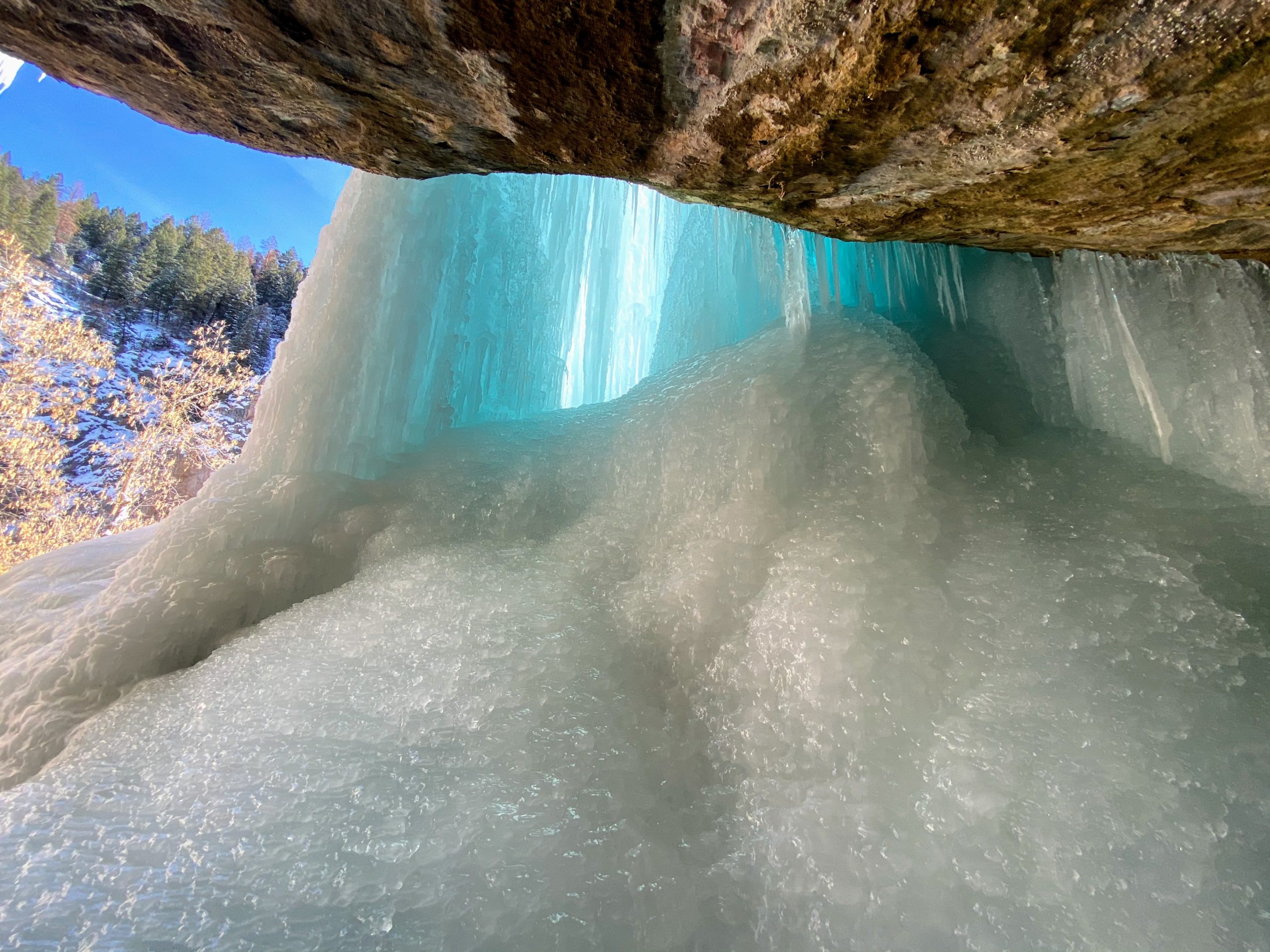
The second cave was larger. It’s memorizing how the ice forms and looks blue. I took some photo with my tripod and selfie stick. I looked at the ice from different perspectives and enjoyed the dripping water noises. The magic of Mother Nature is that apparently, the ice forms slightly differently every year. I mainly heard of the first two caves, but I think there are more. However, the trail onward looked steep and I still wanted to enjoy lunch and the hot springs.

Once people came, I hiked back along the river to the first cave. This was now less busy and so I enjoy taking some pictures, as the blue icicles were particularly striking here.

I was getting hungry now, so I headed out and passed Rifle Gap State Park, which was beautiful with people ice fishing on the reservoir. I headed for the small town of Rifle. I’d read there was a good, small Polish place called Polanka.

It was casual with one woman cooking and working the register. I got some pierogis and potato pancakes, which were delicious. I then explored the small mountain town, which was cute and historic with stunning Mountain View’s. Rifle’s name has something to do with a rifle being leaned up against a tree by an early settler, as I recall. There is a lot of fascinating history in the area.

I headed back to Glenwood Springs, which I had passed though. I had a Marriott certificate that I used to book the Residence Inn Glenwood Springs. I also wanted to try out the famous hot springs. Even when I was a consultant and we passed through the place, it looked interesting.

There are two hot springs, the main Glenwood Springs and Iron Mountain Hot Springs, a smaller riverside spa with several pools. I decided to try Iron Mountain, but they were totally full and said to come back at 3. I decided to check the other hot springs. Both are beautiful in different ways. The Glenwood Springs Hot Springs are a giant pool under snow covered mountains, with a water slide even! I saw it and decided to wait an hour and try Iron Mountain again, and if I couldn’t get in, do Glenwood. I walked into the town and went to a brewery to grab a quick beer.

Like most Colorado mountain towns, Glenwood Springs has a charming downtown full of restaurants, breweries, and pubs, right across from the big hot springs pool. I headed back to Iron Mountain after.

They had a locker room with locks activated by wristband. Now, my best move on this trip might have been bringing a robe. I read somewhere in the reviews someone suggest that. You can bring or rent towels, but a robe is a game changer in changing pools in the 30 degree weather. I just bought a $10 one at Ross, nothing fancy.

The pools are beautiful and overlook the river and mountains. You can watch the geese as they pipe in peaceful spa music. Each pool has a different temperature ranging from 99-108 degrees. While it was busy and the pools were small, I still found I could squeeze into spaces easily as a solo person. I bought a hot sangria and enjoyed the pools, with a goal to watch the sun set.

I love hot springs (see Iceland, Costa Rica, China), so I had a grand time. My hotel, funny enough, was visible across the river, but I had to drive like ten minutes around to get there since I couldn’t float magically across the river.

As a former consultant, I’ve stayed at a Residence Inn (or 2, or 20), and this one is nice. I later found out they give a slight discount at Iron Mountain Hot Springs. I enjoyed a nice shower before heading out to the town for dinner. I saw a nice looking place earlier, so headed to Colorado Ranch House and sat at the bar. It had an upscale Western vibe (I mean don’t worry, upscale still means you can wear your flannel and boots) and I had a delicious salmon pasta, and everyone there was super nice.

I was tired and ready for an early night, especially since I might hike the next day. I knew the famous Hanging Lake was only 10 minutes away, and had read winter was beautiful and a good time to beat the crowds. However, I was concerned with how cold it would be in the morning, so I decided to wait and see.

It was very cold the next morning, like 12 degrees. I ate my hotel breakfast. The sun came out, and I had the gear, so I went online and bought my permit. The permit system is relatively new, but I read that Hanging Lake during the summer would sometimes get 1300 visitors PER DAY, and people were out of control swimming in the pristine turquoise waters and peeing everywhere.

Even in winter there is a permit, but you can park at the trailhead, right off I-70, and don’t need an assigned time. There were only a few other cars. With my spikes, poles, and 2 pairs of gloves, I set off. It was very cold still, like 18 degrees. The hike is within the Glenwood Canyon area and has stunning rock views. Just beautiful. I also worried that it was an uphill slog (but at least it would keep me warm?), even though it’s only 3 miles round trip, and to allow 3 hours, which is a lot in the cold.

The hike up was nearly empty. It was all snow covered, but seemed almost groomed? And very packed down. So the hike was not technically difficult. It was beautiful to hike alongside a snow-covered river. I passed two women (I never pass people!) and headed up. There started to be some gorgeous canyon views. The canyon kept a lot of the hike in the shade, but I worked up a sweat hiking uphill.

Towards the end, there was a railing and a steep overlook that challenged my fear of heights. I started to freak out a little bit, but eventually decided holding the railing was the best way up, and right after that, I was there. Much sooner than I thought.

I had the famous Hanging Lake to myself (for about 15-20 minutes). It’s an odd place, at the edge of this cliff, for a beautiful frozen fall and ice covered lake. The blue color comes from minerals, but it was too ice covered to get the vibrant coloring. However, the sun was out, and the place is beautiful. I enjoyed some snacks, water, and photo taking before others started to join me.

Hanging Lake Winter

Heading back down the scary railing part was tough, but I held the railing again and at least knew what was coming, and after that, it was easy going downhill. I kept up my speed to keep warm, and passed many more people. The whole thing only took me a couple of hours, and I was pleased with myself on a known difficult hike. Plus, I had a very rare and special experience of enjoying Hanging Lake solo.

However, I was frozen to my core at this point and dreaming of hot springs again. I headed back to Glenwood and grabbed some lunch. Then, because it was Monday and I could use a coupon from my hotel, it was only $18 to go back to Iron Mountain Hot Springs. I headed back and it felt amazing to be hot again after my hike in the freezing cold.

Traffic would be bad no matter what time I left (ski traffic and accidents on I-70), and eventually I headed out. But it’s hard to complain about the most stunning views of snow covered mountains in the world when you’re in standstill mountain traffic.

It was an amazing trip and I highly recommend Rifle Falls and Ice Caves, Hanging Lake, and Iron Mountain Hot Springs in the winter (with spikes and poles necessary for the hiking). Even if you get stuck in ski traffic (not if, you will), you can stare at the beautiful scenery that people come from around the world to see.

Recommended Gear: I am able to get a small commission through affiliated ads for recommending this gear; however, I only recommend things I use and love. Kahtoola Microspikes are amazing and I used them for the Ice Caves and Hanging Lake adventures to help grip the ice. 


Steamboat Springs, CO

September 27 and 28, I decided to go for a weekend getaway to Steamboat Springs. I knew they were supposed to get leaves changing earlier in the northern part of the state. Also, I had briefly stopped at Steamboat Springs on my way back from the Mount Zirkel Wilderness and was really charmed by the scenery, arts, and culture of the town.

So I had made this drive before, but it was stunningly different now as the leaves were changing.

IMG_9033.JPGFall in Colorado is special. There are brilliant colors set against the peaks.

IMG_9038It was definitely hard not to stop to try to capture the leaves along the way like every few minutes.

Driving into Steamboat was so gorgeous. The mountains were covered in multi-colored leaves. I stopped in at the visitor’s center to ask for some advice on things to do. It looked like some rain might roll in, and I wanted to head into the Strawberry Park Hot Springs before that.

The drive up to the hot springs was pretty short but magical, as the sun shown through the yellow aspen leaves.

IMG_9044.JPGIt was a great time to be in the hot springs. You could sit and view the beautiful leaves changing. As ever, the photos don’t really do the vibrancy of the sun shining through the leaves justice.

IMG_9052There were different temperatures you could experiment with in the different pools. One was more lukewarm up to pretty hot. It was really beautiful and I stayed for a while.

I had a dinner reservation for Restaurant Week in the evening, so I got out and headed to my hotel. Before I left I wandered around my hotel. It was just a Quality Inn, but I really enjoyed the scenery around.

IMG_9078.JPGCafe Diva was located in the ski village part of Steamboat Springs, so I headed over there at 5 pm, a nice early reservation for a solo diner. The place filled up quickly and the staff were very nice in serving me the preset restaurant menu with wine pairings.

IMG_9095I really enjoyed everything. The first course is pictured below.

IMG_9099After that lovely treat, I knew there was an event downtown at the art museum for painting en plein air as artists depicted autumn scenes around Steamboat Springs. It turns out there’s a free bus that goes all the way around Steamboat Springs, even to the Quality Inn!

IMG_9110 (1).JPGThe event was great. There was free wine and it was packed. There were prize winning pieces and everything was for sale.

After that, I wandered around Steamboat Springs, which was just charming at night. The trees were strung with lights and there were tons of lively bars and restaurants. I found a lively place downstairs from the street called The Barley, with lots of craft beer and live music. I took the night bus back to my hotel after that.

The next day, I woke up fairly early to check out Fish Creek Falls. I had heard at the visitor’s center that the second falls wasn’t as good as in summer with snow run off. I mostly wanted to go for a fall leaf hike, so I planned to view the first falls and maybe start to head up to the second falls.

Before the falls, I stopped at the Smell That Bread Bakery and got a blueberry cinnamon roll pastry. It wasn’t too busy as I arrived, but got busier into the later morning (9-10 am). I took an easy paved path around to view the falls, and really enjoyed the views there before descending toward the falls.

IMG_9142I saw a river otter in this area! He was moving really fast but I got really excited as I watched him crawl over rocks and swim through the river water.

I enjoyed relative solitude heading up the path toward the second falls and watching the sun shine through the leaves. I could see why the artists used so much pink in their paintings. I did not want to do the entire 5 miles though, so I turned back. I had other things I wanted to do.

IMG_9128Steamboat Springs has the most charming little bookstore called Off the Beaten Path. It’s also a coffee shop, and I included a picture of the menu below.

IMG_9185.JPGIt was really beautiful and sunny out, so after that I started to scope out a lunch spot. There were some restaurants along the river and I stumbled upon Sunpies. It was a casual joint where you could drink a beer and eat some fried clams along the Yampa River.

IMG_9198.JPGWith this view and the sun out, I struggled to leave the place for a while. I thought I might do something suggested at the visitor’s center and ride the chairlift at the ski resort for the views.

The ski resort was mostly filled with mountain hikers, who take their bikes on the lift and then bike down the mountain. The views were of course stunning, but I did find parts of the ride pretty terrifying due to my fear of heights! The view below was one of my favorite parts.

IMG_9201.JPGIMG_9204After my ride, I headed back to the downtown area. There was a chili cook-off with live music, so it was lively, plus it was gorgeous out. I enjoyed shopping. I found a store I really liked and got a couple of shirts and stickers. I knew I had a long drive back but struggled to leave, as I wanted to linger by the river and read the new book I got at the bookstore.

The drive back was beautiful. This view is quite close as you leave or come into Steamboat.

IMG_9240

I really enjoyed my weekend in Steamboat Springs. It’s full of surprises for such a small place. Of course there is natural beauty, but lots of arts and culture and some great restaurants. I definitely want to return and explore more!


Summer Hikes in Colorado

Since I moved to Colorado in January, I’ve had to learn a whole new terminology and approach to hiking. “Have you hiked a 14er yet?” everyone will ask. This is one of the mountains that is 14,000 feet or higher, of which there are many. Some people “bag peaks,” talking about the mountains they have summited. People will refer to hiking the “front range,” meaning both the Southern range of the Rockies and the urban region just east. This as opposed to the part of Colorado that is the “western slope” which is west of the Continental Divide.

There are also some hikes you can only really do during a short period of summer due the elevation and the amount of snow (if you don’t want to snowshoe or ski, that is!). So I learned, that in the summer, you want to get to those places you won’t be able to get to much of the year, or that will be snow covered most of the year. The summer also has monsoon thunderstorms in the afternoons, so you have to do some planning not to get yourself on a peak or above treeline during lightning. It’s definitely recommended to start early, which I’d usually do anyways to try to get any kind of decent parking.

I was also training for my Iceland trek, and wanted to make sure I got in some long hikes with my pack before my trip.

I went to a presentation at REI by the author of the book Base Camp Denver, and he recommended several summer hikes that I ended up doing. The amount of hikes you can do is almost overwhelming, so it was nice to have a list.

Here are some of the hikes I did this summer:

Great Sand Dunes National Park

My friend Lacey and I did this over Memorial Day Weekend. We did not do any strenuous hiking beyond walking around. It was pretty tough to walk uphill in sand, and kind of scary for me with the height (which is lame since you would fall on sand). Lots of people “sandboard” down the sandy hills. You can actually summit some of the dunes. It’s an incredible place to visit, and insane how snow capped peaks loom over sand dunes.

IMG_5495 (1).JPG

Chicago Lakes 

This is near Idaho Springs, and I did this hike near the end of June. You drive up a mountain and feel like you’re going to the middle of nowhere, and then arrive at Echo Lake with tons of people parked down the road. The full hike is 9.1 miles with 2,142 feet elevation gain. I only went to the first lake though. It has diverse terrain like many Colorado hikes. You start going downhill through a forest (which means coming back uphill, not super fun on the way back!), then there is a dirt service road for a while, then a reservoir, then a lot of uphill to the lake, which is gorgeous. I started to head to the second lake but it was muddy with snow melt and a lot of big rocks to navigate over. There is also a bit which challenged my fear of heights where the trail is fairly narrow and you’re walking on the side of the mountain with a drop off. The views are beautiful of course.

IMG_5672-EFFECTS.jpg

Lost Creek Wilderness

I did the Goose Creek Trail over 2 days backpacking over the 4th of July weekend. This is backpacking central – nearly everyone I saw on the trail had their pack and there are a ton of well-used campsites in this back country. I did around 5-6 miles the first day, which was a lot of uphill. You walk into the forest along a creek, through some tall trees that felt like a fairyland forest, and see tons of weird but cool looking rock formations. There were tons of wildflowers too. And even an old pioneer era cabin. It was awesome. I camped by a creek and set up my hammock for the afternoon and evening. The only downside was bugs and some rain at night. The morning was gorgeous and hiking downhill the same 5-6 miles was much easier, allowing me to really take in the scenery. I even saw some deer.

IMG_5756.JPG

Golden Gate Canyon State Park

I feel like this park is kind of a hidden gem that is only an hour outside of Denver, near Golden. I also backpacked here on Mountain Lion Trail, a 7 mile loop. There are established campsites that you book at the visitor’s center. There were a ton of wildflowers on this hike. I hiked around 5 miles the first day. My camp was near a creek and once again, I had great hammocking trees. I only had to hike out a couple of miles in the beautiful early morning light.

IMG_5823.JPG

Paint Mines

My friend Lacey found this place and we headed there one Saturday at the end of July. It’s really in the middle of nowhere (El Paso County). It does not take too much hiking to get to the rock formations, which are insane. The colors are just amazing and you can spend some time walking around them. It’s not insanely busy and another hidden gem in Colorado. I’m glad Lacey found this place!

IMG_5981

McCullough Gulch

The full mileage is around 6 miles for this trail near Breckenridge. I went at the beginning of August and only went to the first lake, so it was more like 4.5 miles for me, but this was one of my favorite hikes. You only have to go a couple miles in to get some good bang for your buck. The mountain scenery is gorgeous to start. There is some uphill and you quickly reach a waterfall. Then you hike to a gorgeous lake. I tried to hike to the next lake but found the trail confusing, and I did this hike in an afternoon, so I headed back instead.

IMG_6069.JPG

Mills Lake, Rocky Mountain National Park

I planned to hike to Black Lake in August, a 10-mile hike in Rocky Mountain National Park. I woke up early and made the 2 hour drive, arriving around 7:30. I had been wanting to go to the national park for a while and finally made it! I parked in the park and ride and took the shuttle to the trail head. The trail is quite paved and easy for a bit and then gets rocky. You fairly quickly reach Alberta Falls. Then, you reach Mills Lake, a gorgeous alpine lake. I ate my snacks here and carried on, but it started to rain. I had my rain jacket, so I kept going, hoping the rain would let up. I looked at the sky and saw no sign of sun (there had been no rain in the forecast for the morning). I decided to turn back and the rain did not let up. I ended up hiking 6.5 miles in around 3.5 hours, which was making me feel better about my abilities to hike in Iceland.

IMG_6158.JPG

Mount Zirkel Wilderness

This was my last trip before Iceland. I ended up hiking 10 miles each day there. This was in mid-August. This was about 3 hours away closer to Steamboat Springs, and includes around 6 miles on a rough dirt road (my Honda Fit could make it but I went slow). The first day I wanted to hike to Gilpin Lake, which I had seen pictures of. This wilderness has EVERYTHING, with all of the magical fairy tale forest feelings, wildflowers, waterfalls, and deer, pika, and marmots.  I got to the first lake, but started to feel the effects of altitude sickness to a mild degree (dizziness, nausea). I remembered that my hiking safety class had said the best cure for altitude sickness is to come down from the altitude, so even though I was a mile from Gilpin Lake, I came down.

The next day, I was determined to get to that lake. It was a tough hike with lots of uphill and elevation gain. It was worth it in the end. I mean, look at this lake.

IMG_6281.JPG

It’s surrounded by trees so it is perfect for hanging your hammock.

IMG_6268.JPG

I couldn’t stay for as long as I liked as I was worried about impending storm clouds. So I booked it back down (and of course it never stormed). I was utterly charmed when I stopped in Steamboat Springs to devour a gigantic breakfast dish. I definitely want to get back there.

There are SO many hikes to do in Colorado in the summer (I didn’t even summit a 14er). I really enjoyed the hikes I did do. I am excited for fall, which is a season I haven’t experienced in a while. I definitely plan to do some “leaf-peeping” and plan some trips around fall leaves.