Nick and I had a four-day weekend for 4th of July, and were definitely wanting to do a backpacking trip July 2-5. We had originally been considering Ice Lakes and Island Lakes in the San Juan mountains in Colorado, but the entire trail is closed for summer 2021 due to fires/overuse. We put a few possible trips on our list and kept an eye on the weather, which at first was predicting storms, and then decided to do the Highland Mary Lakes Loop in the San Juans near Silverton, about a 7 hour drive from Denver.
Day 1
It is a fun drive from Denver to this area – we went through Fairplay, Buena Vista, and skipped Salida this time, stopping in Ridgway for lunch. What I did not realize was we would be driving the famous Million Dollar Highway, which is between Ouray and Silverton. We were taking turns driving and I started to get a lot of anxiety so Nick took over. Now I feel a lot better knowing this is considered one of the most dangerous, windy roads; however, it is absolutely phenomenal scenery. I would highly recommend it despite the fear of heights. There are mountains colored red from oxidized minerals.


There are numerous mining ruins throughout this entire region, and some educational signs along the highway at viewpoints. We got to Silverton, but needed to get to the trailhead, so drove through. Silverton is a beautiful Victorian mining town.
We were originally planning to drive to the Colorado Trail Segment 24 trailhead as an “add-on” to the loop, since it is considered a beautiful part of the trail. However, as soon as we left Silverton, we were on narrow dirt roads mostly occupied by OHVs and large trucks. These are clearly old mining roads with lots of mining ruins. We attempted the road to the Segment 24 trailhead and it just did not seem feasible in our Crosstrek; we knocked a plastic cover off our car. So, we turned around and headed to the Highland Mary Lakes trailhead, nearby, to just do the regular loop.
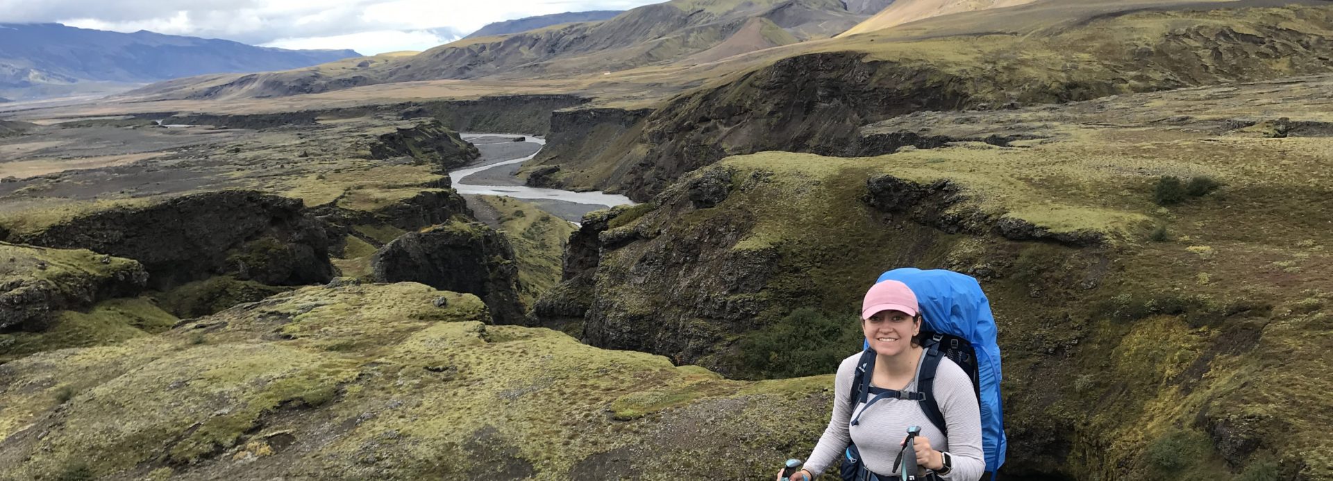
The scenery is like a painting the whole time. The road was rough and rocky so we proceeded slowly, and we saw bunches of wildflowers and marmots running. There is dispersed camping near the trailhead so we saw people camping all over. We parked and decided to proceed with the river crossing to the trail on foot.

We started hiking, intending to possibly even camp by the lakes the first night, since it was only a couple of miles. But the trail was extremely steep and we were very tired from the drive. So we decided to camp at a spot we found fairly close to the trailhead, near a waterfall. Even the small bit of hiking was stunning; I’ve never seen so many columbines.

We set up our camp and read near the waterfall for a little bit before heading to bed.

Our campsite was very peaceful, and we were glad we had stopped to rest. We had the entire next day to head to the lakes in the morning, which was a great feeling.

Day 2
We woke up early the next morning and had less than 2 miles to hike to the lake, but it was steep! We were also at high elevation, which makes everything feel harder – breathing, walking, and certainly backpacking. The lakes were above treeline at 12,000 feet.
But the scenery is so beautiful you really do not mind stopping to catch your breath.

We had to climb over a rocky section to get to the lakes that was a bit tricky.

We arrived to the lakes still quite early in the morning and saw just a few tents. We found a perfect camping spot by the third lake, 100 feet from water as required but with amazing views.

This was quite a leisurely day in which we explored the lakes, ate, and read. The weather held up nicely and we did not get any storms. We found a lovely kitchen/dining spot.

I was able to finish a book and complete its prequel on this trip as well, which was amazing.

There were some day hikers, backpackers, and trail runners, but it was amazingly uncrowded for a holiday weekend, and it seemed like there were few people camping by the lakes. We went to bed early with lake breezes blowing into our tent.

Day 3
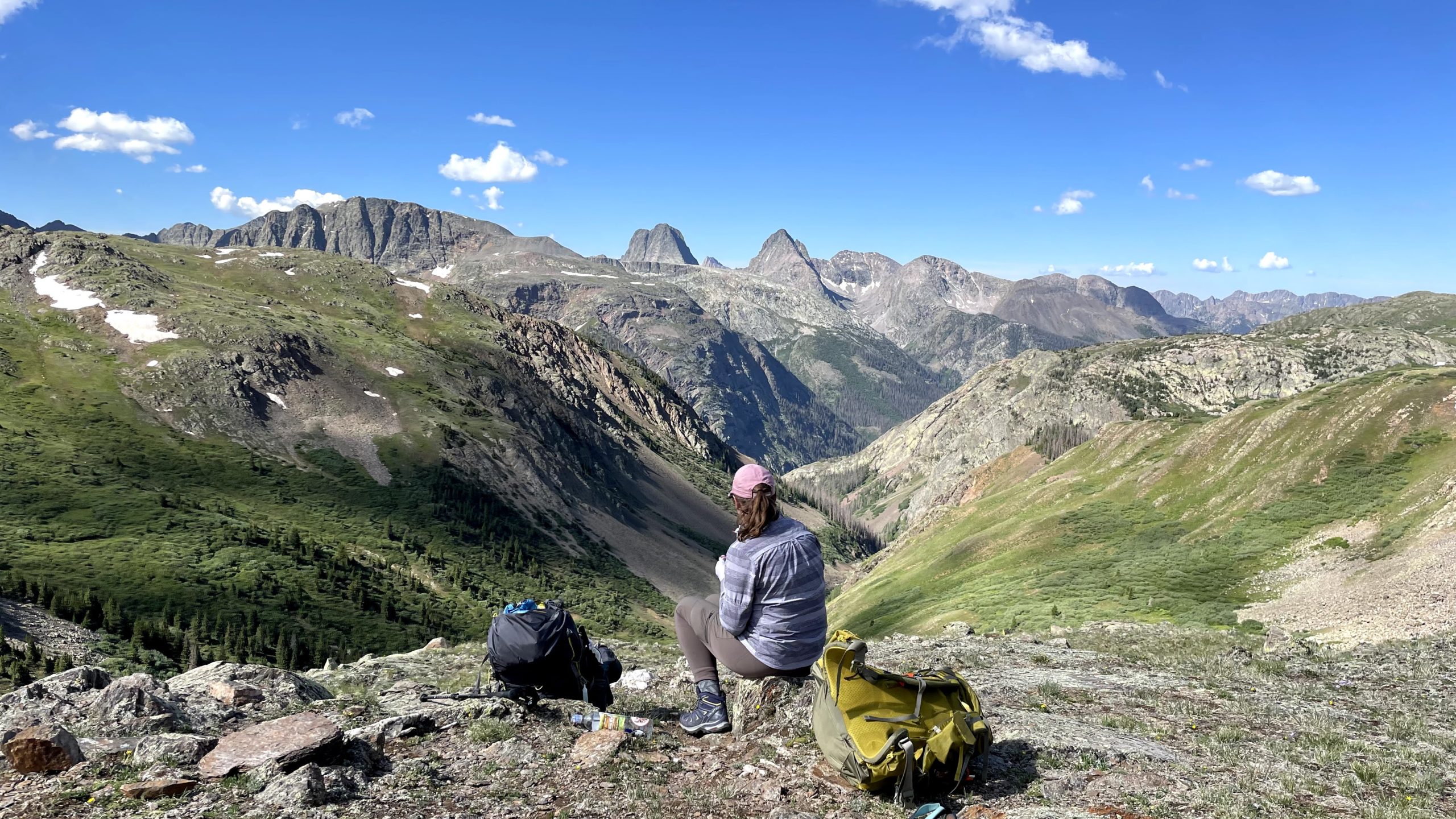
Once again, we woke up early. We had breakfast and coffee on our cooking and dining rock and enjoyed last views of the lakes. We were excited to climb to the top of a hill and get views of the lakes. We decided we would have hot chocolate and snacks at the Verde Lakes. People had some pretty incredible camping spots. These lakes were gorgeous with the epic mountain views starting to peek through.

We were excited as we continued on, because we knew we would be connecting with a section of the Colorado Trail that is also along the epic high-altitude Continental Divide Trail, a thru-hike from Mexico to Canada. These sections are supposed to some of the best.
On the way to the connection with the CDT, we started to get some stunning Lord of the Rings style mountain views.

Best snack break ever?

The Continental Divide Trail has these markers, so we are trying to take pictures every time we conquer a small part of the trail.

The scenery only got more beautiful as we went along. We met a Continental Divide thru-hiker, who had a bag of Fritos strapped to his pack (never has anything looked so good). He said he had been in this area in May and it was absolutely snow-covered, so they had done the New Mexico portion and then planned to do the Wind River Range next.

We soon left the CDT but the gorgeous scenery continued. Tons of flowers. We started to look for possible campsites, but there was not much flat land with water near.

We had decided to camp another night so we didn’t have to hike and drive 7 hours in the same day. We wanted to give ourselves an easy last day and time to enjoy the drive. As we reached Cunningham Gulch, the last section of the loop, we managed to find a flat spot for camp. It required some steep climbs up and down slippery rocks for water, but then we settled in for reading and eating.

We once again went to bed early, after a day full of remarkable views and mostly easy hiking at high elevation, with some steep and rocky downhills.
Day 4
We had an easy, short hike out the next day, crossed the river back to our car, and drove the rough road to Silverton.
Silverton is a beautiful preserved Victorian town, with colorful buildings surrounded by mountains. We stopped for pastries and coffee at Coffee Bear, a charming coffee shop with a rooftop deck.

We then could take our time on the Million Dollar Highway to stop at some of the viewpoints and read about the immense mining projects that went on here. The region seems remote even now from Denver, so it’s fascinating imagining what it was like in the past. Here is Nick with the mountains and some mining ruins.

As you drive to Ouray, there is a sign declaring the town to be the “Switzerland of America.”

It’s definitely worth enjoying your time on this highway.

Once in Ouray, we tried to find a breakfast spot as it was still quite early but there was really nothing open. We headed down the road to Ridgway, and waited about an hour and a half for what turned out to be a huge green chili breakfast. The mountain towns have suffered worker shortages even pre-pandemic, due to a lack of affordable housing, which has been worsened by the pandemic. So this wait probably would have held anywhere similar we tried to go.
We then had a long drive home featuring rain and lots of traffic. It was all worthwhile for this incredible trip. This region of Colorado is harder to get to, but the hiking and scenery is remarkable, along with the charming preserved towns. We can’t wait to see more of it!